Krafla Lava Fields
Krafla is an active volcanic system near Lake Myvatn with vast lava fields, steaming vents, and the Viti explosion crater. The Leirhnjukur lava field from the 1975-1984 Krafla Fires eruptions is still warm underfoot in places.
Fire and Earth at Krafla
Krafla is not a single volcano but an entire volcanic system — a 90-kilometre-long fissure swarm stretching across northeast Iceland with a central caldera 10 kilometres wide. The area around Lake Myvatn has been shaped by repeated eruptions over thousands of years, and the most recent series, the Krafla Fires of 1975 to 1984, left behind lava fields that are still cooling today.
The landscape here is unlike anywhere else in Iceland. Black and rust-red lava stretches in every direction, split by cracks and punctuated by hissing steam vents. Sulphur deposits colour the ground yellow and green around fumaroles. In places, the rock is warm to the touch. This is geology in action, visible and tangible.
Leirhnjukur Lava Field
The main walking trail starts from the Leirhnjukur car park and follows a 2.5-kilometre loop through the heart of the lava field. The path is marked with stakes and passes through some of the most striking volcanic terrain in Iceland. You walk across ropey pahoehoe lava, past bubbling mud pots, and beside steaming fissures where the earth's heat escapes.
The lava here came from the Krafla Fires — a series of nine eruptions between 1975 and 1984 that produced enormous volumes of basalt. The youngest flows look almost fresh, with a glassy surface and sharp edges. Older sections have been colonised by moss, creating the distinctive black-and-green patchwork that Iceland is known for.
The trail is mostly flat but the surface is uneven. Sturdy shoes are essential. Stay strictly on the marked path — venturing off-trail risks breaking through thin crust into scalding ground below.
Viti Crater
A few kilometres from Leirhnjukur, the Viti explosion crater offers a completely different perspective. This 300-metre-wide crater was blasted into existence during the Myvatn Fires of 1724, a devastating eruption that destroyed farms across the region. Today, a milky turquoise lake fills the bottom of the crater, and a walking path follows the rim with panoramic views.
The contrast between the deep blue-green water and the barren, rust-coloured crater walls is striking, especially on a clear day. The walk around the rim takes about 20 minutes and is mostly level, though some sections are narrow.
Krafla Power Station
On the drive between the two sites, you pass the Krafla geothermal power station. Iceland harnesses the same volcanic energy that creates these landscapes, and Krafla has been generating electricity since 1977. The power station is not open to tourists, but the sight of steam rising from the industrial pipes against the volcanic backdrop is a reminder of how Iceland turns geological forces into practical energy.
Getting There
From Akureyri, drive east on Route 1 for about 90 kilometres to the Myvatn area, then follow Route 863 north toward Krafla. From Reykjahlid village at Myvatn, the drive is about 20 minutes. The road is paved to the Viti car park, with a short gravel section to Leirhnjukur. There are no facilities at either site — bring water and dress for changeable weather.
Frequently Asked Questions
- Is it safe to walk on the lava fields?
- Yes, there are well-marked trails through the Leirhnjukur lava field. Stay on the paths — the ground can be thin and unstable in places, and steam vents can be extremely hot. The marked routes are safe for all visitors.
- How do I get to Krafla?
- From Myvatn, drive east on Route 1 and turn north on Route 863 toward the Krafla power station. The Viti crater car park is about 7 km up the road, and the Leirhnjukur parking area is a further 3 km on a signed gravel road. The total drive from Myvatn is about 20 minutes.
- Can I visit in winter?
- Yes, the road to Krafla is usually kept open year-round. The geothermal heat keeps parts of the area snow-free even in winter, creating dramatic contrasts. However, some walking trails may be icy or closed — check conditions before visiting.
- What is the Viti crater?
- Viti (meaning 'hell') is an explosion crater formed during the Myvatn Fires eruption of 1724. It contains a milky turquoise lake about 300 metres across. A path circles the rim with views down into the crater and across the surrounding volcanic landscape.
- How long should I plan for a visit?
- Allow 1 to 2 hours for the Leirhnjukur lava field walk (2.5 km loop) and an additional 20 to 30 minutes for the Viti crater viewpoint. If you want to explore both thoroughly, plan for a half day.
Book Unforgettable Iceland Experiences — Akureyri
From glacier hikes to northern lights tours — browse hundreds of activities and book with free cancellation.
Browse ActivitiesRent a Car and Explore Iceland
Freedom to roam the Ring Road and beyond. Compare car rental deals in Iceland.
Compare Car RentalsMore Attractions in Akureyri
See all →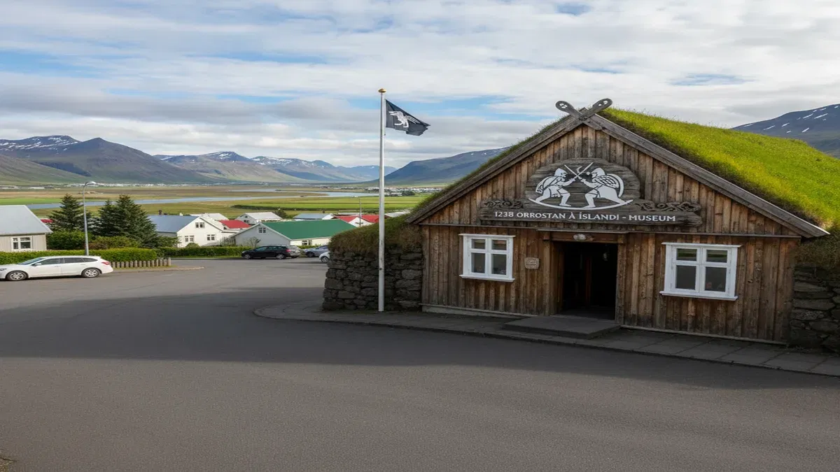 Akureyri1-2 hours
1238: The Battle of Iceland
An immersive virtual and augmented reality museum in Saudarkrokur that brings Iceland's bloodiest medieval era to life. Through VR battle simulations, interactive exhibits, and multimedia storytelling, visitors experience the dramatic events of the Age of the Sturlungs and the Battle of Orlygsstadir in 1238.
 Akureyri1-2 hours
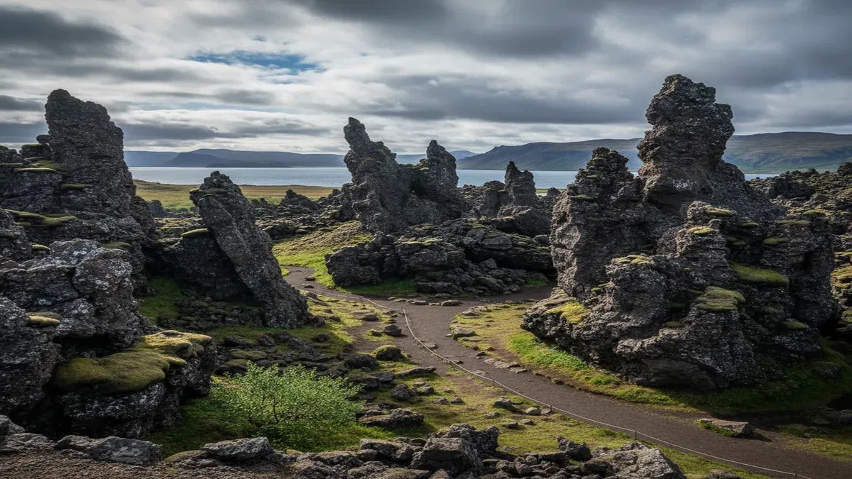
Dimmuborgir Lava Formations
A vast labyrinth of towering lava pillars, arches, and cave-like formations near Lake Myvatn, known as the Dark Castles. Formed over 2,300 years ago when a lava flow collided with a lake, Dimmuborgir is steeped in Icelandic folklore as the legendary home of the Yule Lads and their troll mother Gryla.
 Akureyri20-30 minutes
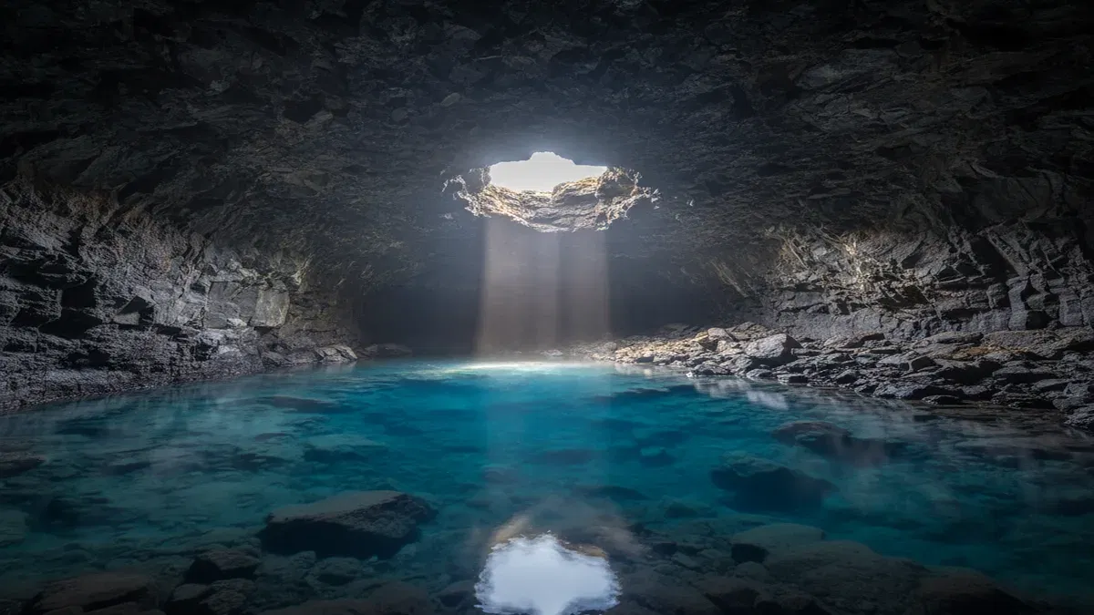
Grjotagja
A small lava cave near Lake Myvatn with a geothermal hot spring inside, famous as a Game of Thrones filming location and for its turquoise blue water that is too hot for bathing.