Hengifoss Waterfall
Iceland's third tallest waterfall at 128 metres, Hengifoss is distinguished by its striking red clay layers sandwiched between dark basalt strata in the surrounding cliff face. The moderate hike from the shores of Lake Lagarfljot passes Litlanesfoss, a smaller waterfall framed by hexagonal basalt columns.
A Geological Masterpiece in East Iceland
Hengifoss is not just a tall waterfall. It is a window into millions of years of volcanic history, displayed in a cliff face that reads like the pages of a geological textbook. At 128 metres, it ranks as Iceland's third tallest waterfall, surpassed only by Morsarfoss and Glymur. But what sets Hengifoss apart is not its height alone — it is the vivid red clay bands that stripe the surrounding basalt, creating a visual effect unlike anything else in the country.
The waterfall is fed by the Brekkuselslaekur stream and drops into a narrow amphitheatre carved into the eastern slopes above Lake Lagarfljot, roughly 35 kilometres south of the town of Egilsstadir in East Iceland.
The Hike
The trail begins at a car park off Route 931, on the western shore of Lake Lagarfljot. From the car park, the path climbs steadily through open hillside with sweeping views over the lake and the Fljotsdalur valley below. The terrain is mostly well-maintained, with sections of boardwalk and steps on the steeper parts, though it can become muddy and slippery in wet conditions.
About 1.2 kilometres in, roughly 30 minutes from the start, the trail reaches Litlanesfoss. This 30-metre waterfall is framed by tall, perfectly formed hexagonal basalt columns that flare outwards on either side of the cascade. It is a striking sight in its own right and many visitors consider it a highlight equal to Hengifoss itself.
From Litlanesfoss, the trail continues uphill for another 1.3 kilometres, gaining elevation through a series of switchbacks. As you climb higher, the red clay bands in the cliff face become increasingly visible. The final approach brings you to a viewpoint at the base of the gorge, where Hengifoss drops the full 128 metres in a single cascade against the layered cliff.
The Geology
The cliff surrounding Hengifoss preserves a record of volcanic activity spanning the Tertiary Period, approximately 5 to 6 million years ago. Each dark basalt layer represents a separate lava flow. Between these eruptions, warm and damp conditions allowed soil to form on the cooled basalt surface. When the next eruption buried this soil under fresh lava, the iron-rich clay oxidised and turned red.
This cycle repeated over millions of years, producing the alternating bands of dark basalt and bright red clay that make Hengifoss so visually distinctive. Scientists have also found fossilised conifer trunks and lignite — compressed peat resembling brown coal — within these layers, evidence that Iceland once supported forest cover in a much warmer climate than it has today.
Practical Information
The car park charges a parking fee of 1,000 ISK, payable online. There are toilets at the trailhead, and a food truck operates during the summer months serving coffee, waffles, and soup. The trail itself is free to access.
From Egilsstadir, follow Route 931 south along the eastern shore of Lake Lagarfljot. The drive takes approximately 30 minutes on a well-maintained road. The trailhead is clearly signposted. Sturdy hiking boots are recommended, and bring a waterproof layer regardless of the forecast — weather in East Iceland changes quickly. In winter, the trail may be icy or snow-covered, so check conditions locally before setting out.
Frequently Asked Questions
- How long is the hike to Hengifoss?
- The trail is approximately 2.5 kilometres each way, making a 5-kilometre round trip with around 300 metres of elevation gain. Most hikers complete the return journey in 2 to 2.5 hours, though allow extra time for stops at Litlanesfoss and at the viewpoint below Hengifoss itself.
- What causes the red stripes in the cliff face?
- The red layers are ancient clay deposits rich in iron oxide. During the Tertiary Period, roughly 5 to 6 million years ago, volcanic eruptions laid down successive basalt layers. Between eruptions, soil formed in the warm, damp climate. When fresh lava flowed over this iron-rich soil, it oxidised and turned red. The repeating cycle of eruption and soil formation created the distinctive striped pattern visible today. Fossilised conifer trunks and lignite found in these layers confirm that Iceland's climate was significantly warmer during this era.
- Is the trail suitable for beginners?
- The trail is rated moderate. The path is well-marked and begins with a steady incline from the car park, but it does gain 300 metres in elevation over 2.5 kilometres. Some sections are steep and the ground can be uneven or muddy after rain. Reasonably fit hikers with sturdy footwear will manage it without difficulty. It is not suitable for pushchairs or wheelchairs.
- What is Litlanesfoss and do I pass it on the way?
- Litlanesfoss, also known as Studlagil, is a roughly 30-metre waterfall located about 1.2 kilometres from the trailhead, around 30 minutes into the hike. The water cascades between symmetrical hexagonal basalt columns, creating one of the most photogenic geological formations in East Iceland. It is well worth stopping here on both the way up and the way down, as the light changes the appearance of the columns throughout the day.
Book Unforgettable Iceland Experiences — Egilsstadir
From glacier hikes to northern lights tours — browse hundreds of activities and book with free cancellation.
Browse ActivitiesRent a Car and Explore Iceland
Freedom to roam the Ring Road and beyond. Compare car rental deals in Iceland.
Compare Car RentalsMore Attractions in Egilsstadir
See all →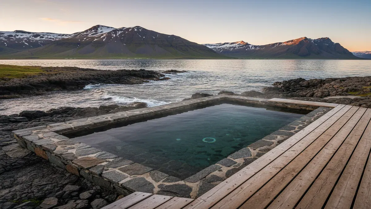 Egilsstadir30-60 minutes
Djupavogskorin
A hidden geothermal pool built into the landscape just off the Ring Road near Djupivogur in East Iceland, offering a secluded soak with views across open plains to mountains and sea.
 Egilsstadir30-60 minutes
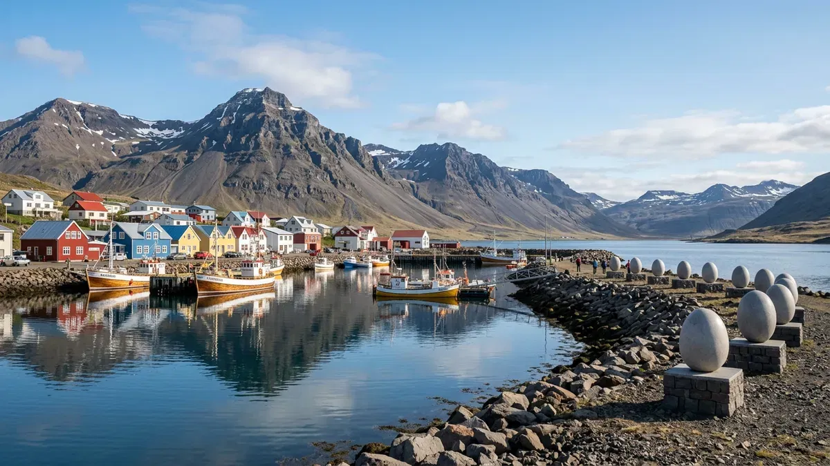
Gamlabúð Visitor Center
Gamlabúð is a historic merchant's building in Djúpivogur that now serves as a visitor centre and cultural space. The 1790 timber building hosts art exhibitions, local history displays, and a café, offering a pleasant stop in one of East Iceland's most charming harbour villages.
 Egilsstadir2-5 hours
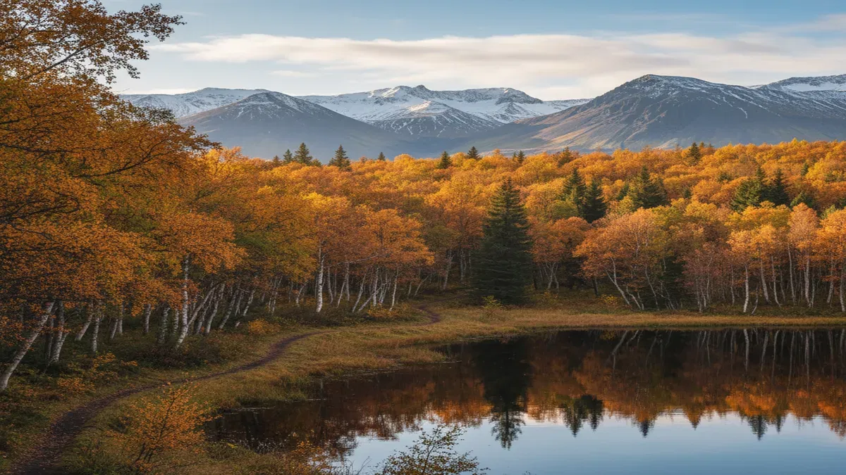
Hallormsstadur Forest
Iceland's largest national forest, spanning 740 hectares of native birch woodland and planted species along the shores of Lake Lagarfljot in East Iceland. Hallormsstadur offers over 40 kilometres of hiking trails, a unique Arctic arboretum, and two scenic campgrounds.