Asbyrgi
A dramatic horseshoe-shaped canyon in Vatnajokull National Park, carved by catastrophic glacial floods thousands of years ago. Asbyrgi shelters one of Iceland's largest birch woodlands and is steeped in Norse mythology.
Asbyrgi is one of the most striking geological formations in Iceland. This enormous horseshoe-shaped canyon, roughly 3.5 kilometres long and over 1 kilometre wide, sits in the northern section of Vatnajokull National Park. Sheer basalt cliffs rise up to 100 metres on all sides, sheltering a remarkably lush woodland on the canyon floor that stands in stark contrast to the barren highlands surrounding it.
Geology and Formation
The canyon owes its existence to catastrophic glacial outburst floods, known in Icelandic as jokulhlaups, from the river Jokulsa a Fjollum. The first major flood tore through here 8,000 to 10,000 years ago, carving the initial depression into young lava flows from the volcanic crater Storaviti. A second, even larger flood around 3,000 years ago shaped the canyon into its present form. The floodwaters divided around a central mass of rock, eroding both sides and leaving behind Eyjan ("The Island"), a 25-metre-high rock formation that splits the canyon almost in half along its length. The river has since shifted its course about 2 kilometres to the east, leaving Asbyrgi as a dry, sheltered valley.
Norse Mythology
According to Norse legend, Asbyrgi was created when Sleipnir, the eight-legged horse of the god Odin, touched one of its hooves to the ground, leaving a colossal hoofprint in the earth. The name Asbyrgi translates roughly to "Shelter of the Gods." Looking at the canyon from above, the horseshoe shape does resemble a giant hoofprint, and it is easy to understand why the early settlers reached for mythology to explain what they saw.
The Woodland
The canyon floor supports one of the largest birch woodlands remaining in Iceland. Protected from wind and grazing by the towering cliffs, birch and willow trees grow to unusual heights here, alongside planted spruce, larch, and pine. Wildflowers carpet the ground in summer. The dense vegetation supports a rich birdlife, including ravens, Northern fulmars, Eurasian wigeons, and various migratory species that nest around Botnstjorn, the small pond tucked against the back wall of the canyon.
Hiking and Exploring
Asbyrgi offers trails suited to nearly every visitor. The walk to Botnstjorn follows the eastern wall through the woodland and is flat and straightforward. For better views, the Klappir trail climbs to the canyon rim, where you can look down into the green valley from the top of the basalt cliffs. More ambitious hikers can tackle the Kviar Circle, a full-day 17-kilometre loop through the surrounding landscape. A short but steep climb to the top of Eyjan rewards you with a view straight down the length of the canyon.
Visitor Information
The Gljufrastofa Visitor Centre, located at the entrance to the canyon, is staffed by park rangers during the summer months from June to September. They can advise on trail conditions, wildlife sightings, and the geology of the area. Asbyrgi also serves as the northern trailhead for the famous multi-day hike through Jokulsargljufur canyon to Dettifoss, one of Europe's most powerful waterfalls, located roughly 30 kilometres to the south.
Frequently Asked Questions
- How was Asbyrgi formed?
- Asbyrgi was carved by catastrophic glacial outburst floods (jokulhlaups) from the river Jokulsa a Fjollum, fed by the Vatnajokull glacier. The first major flood occurred 8,000 to 10,000 years ago, with a second event around 3,000 years ago. The floodwaters split around a central rock formation, eroding the distinctive horseshoe shape. The river has since changed course and now flows about 2 kilometres to the east.
- How do I get to Asbyrgi?
- Asbyrgi is located in northeast Iceland, approximately 60 kilometres east of Husavik along Route 85, a drive of about 45 minutes. From Akureyri, the drive is roughly 153 kilometres. From Reykjavik, it is approximately 540 kilometres or about 7 hours by car along the Ring Road and Route 85.
- When is the best time to visit Asbyrgi?
- The best time to visit is from June to September, when the Gljufrastofa Visitor Centre is open and all hiking trails are accessible. The birch woodland is at its most lush during summer, and the longer daylight hours allow you to explore the full range of trails. The campground operates from mid-May to mid-September.
- What hiking trails are available?
- There are several trails for different fitness levels. The Botnstjorn trail is an easy 8-kilometre return walk along the eastern wall to the pond at the back of the canyon. The Klappir trail covers 9 kilometres along the canyon rim and takes about 3 hours. The Kviar Circle is a challenging 17-kilometre loop taking 6 to 7 hours. You can also hike up Eyjan, the central rock formation that divides the canyon.
- Is there camping at Asbyrgi?
- Yes. The Asbyrgi campground is open from mid-May to mid-September and offers showers, washing facilities, and ample space for tents and camper vans. It is one of the main campgrounds within the Jokulsargljufur section of Vatnajokull National Park.
Book Unforgettable Iceland Experiences — Husavik
From glacier hikes to northern lights tours — browse hundreds of activities and book with free cancellation.
Browse ActivitiesRent a Car and Explore Iceland
Freedom to roam the Ring Road and beyond. Compare car rental deals in Iceland.
Compare Car RentalsMore Attractions in Husavik
See all →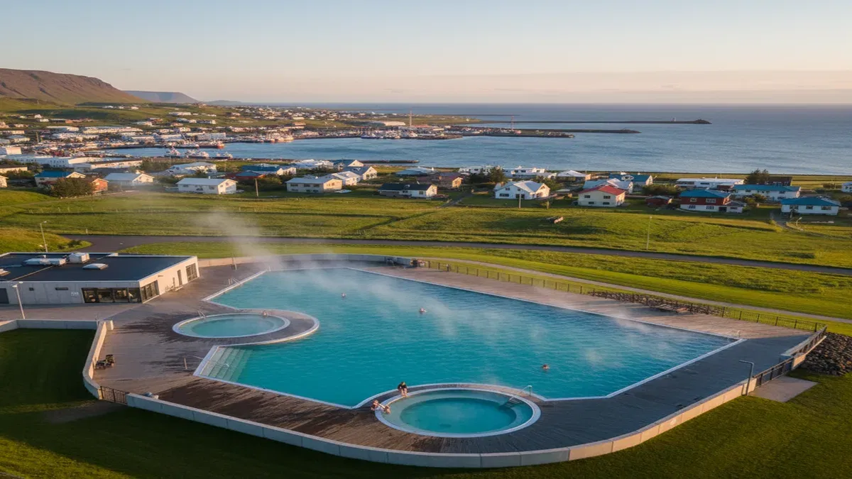 Husavik1-2 hours
Husavik Swimming Pool
A geothermally heated municipal swimming pool in the heart of Husavik, North Iceland. With hot tubs, water slides, and a warm outdoor pool, Sundlaug Husavikur offers an authentic Icelandic bathing experience and the perfect way to unwind after a whale watching tour on Skjalfandi Bay.
 Husavik1-2 hours
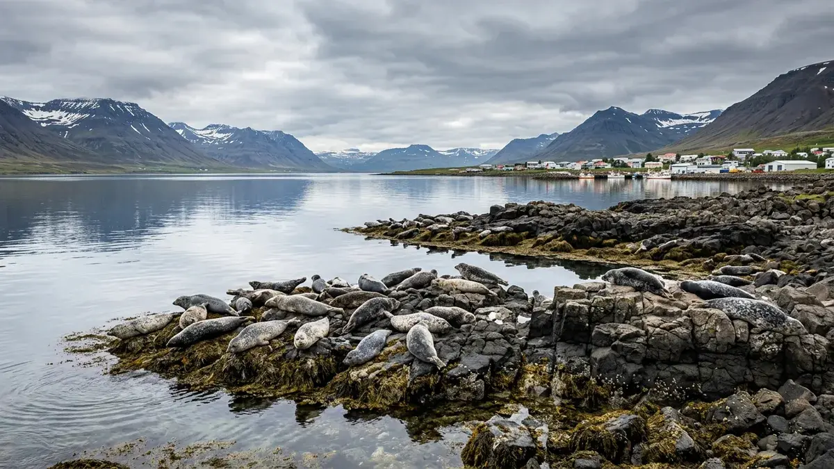
Icelandic Seal Center
The Icelandic Seal Center in Hvammstangi is a research and exhibition centre dedicated to Iceland's seal populations. Interactive exhibits explain seal biology, and the nearby beaches offer excellent chances to spot harbour and grey seals in the wild.